PXLWRKR
← Back to all projects

A New Field-Data Product for the Modern ArcGIS Platform

ArcGIS Field Maps · Esri

ArcGIS Field Maps — hero
ArcGIS Field Maps — hero detail
Role
Co-lead Product Designer
Scope
Product direction, Smart Form authoring, offline map preparation
Team
Product Owner, Product Designers (2), Developers (5), Quality Assurance
Timeline
2020 – 2022
Status
Public, shipped

The work

ArcGIS Field Maps was the field-data product Esri set out to build for the next era of the platform. Three older field-data apps — Collector, Explorer, and Tracker — had each been built independently over the previous decade, each with its own authoring surface, its own offline model, and its own user base. Customers running large field operations were carrying two or three of them at once, training their crews on different interfaces for what was conceptually the same job: take a map into the field, collect data, sync it back. The market had moved past what those apps were built to do, and the platform had moved past the foundations they were built on. Field Maps was the answer — not a consolidation of what existed, but a ground-up product built for what field operations actually looked like now.

The work was hard for reasons that weren't obvious from the outside. The three legacy apps had real, named customers depending on workflows that didn't all translate cleanly into a new product, and the migration story mattered as much as the new product itself. The offline model — how you prepare a map to be usable without connectivity, which is the entire reason most field crews exist — was the most fragmented surface across the legacy apps and the hardest to get right in the new one. The data model behind authoring was "template first," but the workflow customers actually wanted to start from was "form first." And ArcGIS itself was mid-evolution: Field Maps shipped on Calcite, the company design system, which was still being defined through its first product implementation — a constraint that shaped the project from start to finish.

I co-led design on the web product alongside a second designer who joined the team after the initial direction was set. I owned product direction through the foundational sprint and the early sketch and concept phases, partnered with the product manager on scoping and customer development, and led the Smart Forms initiative — the form-authoring experience that became one of the product's most visible features and later propagated to adjacent ArcGIS products. The second designer and I split execution as the product matured, and I led the GIS-domain ramp-up that geospatial work requires of any new designer joining the platform.

Approach and decisions

01

Starting with a five-day sprint, not a roadmap

The team had a clear charter — build the field-data product for the next era of ArcGIS — and no shared picture of what that meant in practice. The product manager and I could have spent the first quarter building a roadmap from the requirements inventory of the three predecessor apps. We didn't. I proposed and facilitated a five-day Google Ventures-style design sprint at the start of the engagement, with the full cross-functional team in a room, treating the question "what is the field supervisor's one-stop-shop?" as a design problem rather than a product-management problem.

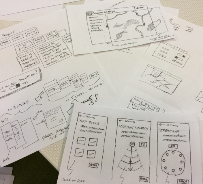
The sprint moved through long-term goal-setting, customer mapping, How-Might-We framing, lightning demos of analogous products, solution sketches, sticky-note decision-making, storyboarding, and a working prototype — the canonical structure from the Knapp/Zeratsky playbook, run faithfully because the team needed the structure more than it needed creative facilitation. The decider in the room — the product manager — got the supervote at the sticky-decision stage. The team left the sprint with one direction and a storyboarded prototype, not five.

What the sprint produced wasn't a finished design. What it produced was an aligned design. The product manager and engineering had been in the room for every decision, which meant the next eight months of scoping conversations started from a shared picture rather than from each function arguing for its own priorities. That was the real return on a five-day investment — not the prototype, the alignment.
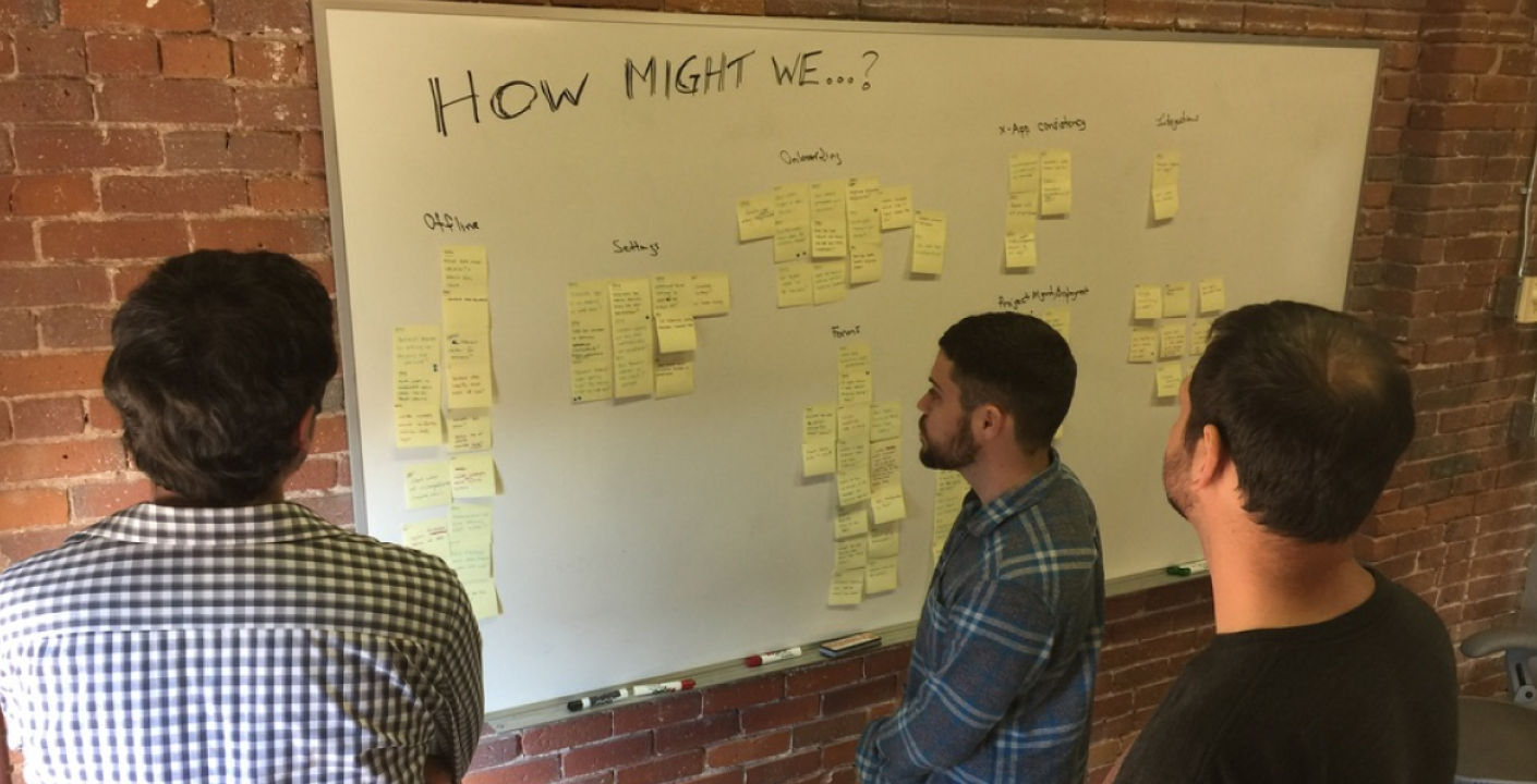
Design sprint — customer map and workshop artifacts
Design sprint — customer map and workshop artifacts. Sprint, days 1–5. The cross-functional workshop that aligned the team before scoping began.

02

Centralizing offline map preparation as the unification surface

The single most fragmented experience across the three predecessor apps was preparing a map to work offline — the workflow that mattered most to about half of all users and the one most likely to fail in the field. Each legacy app had handled offline preparation differently, and the settings that controlled it were scattered across authoring screens, sync screens, and the underlying web map definition. Customers spent training cycles teaching their crews where to find them.

I made the decision early — and pushed for it against some internal resistance — to make offline preparation the anchor surface of the new product. Not the map itself, not the authoring canvas, not the form builder. The offline preparation experience was where the new product's value would be most visible and most valuable to the customer. If we got that right, the rest of the product could differ from the predecessor apps in ways customers would tolerate. If we got it wrong, no amount of work elsewhere would matter.

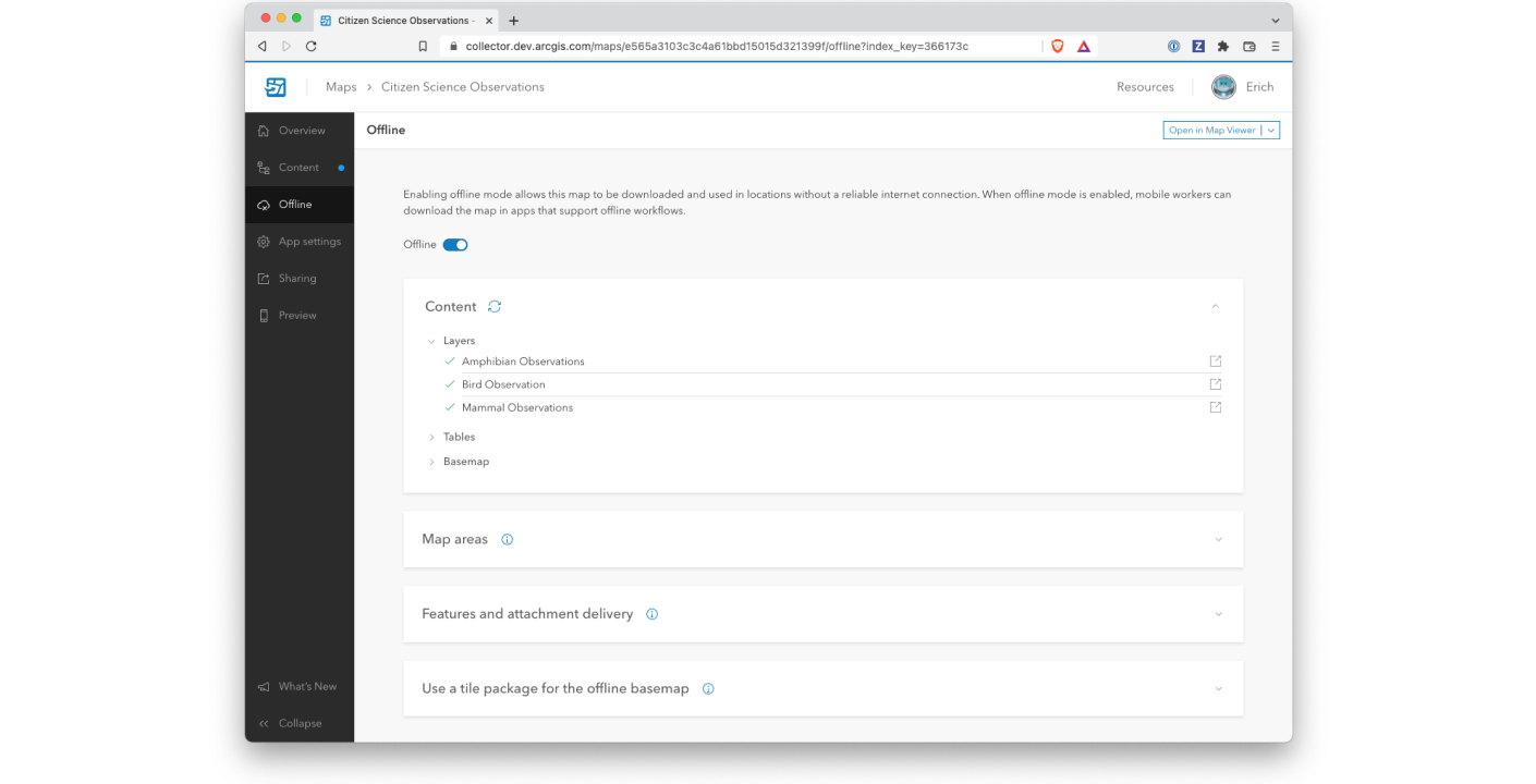
The redesign centralized every offline-related setting into a single, sequential workflow inside the web authoring experience — extent selection, layer selection, basemap caching, sync behavior, and the diagnostic feedback that told the supervisor whether the map was actually viable offline. The supervisor saw the offline experience as one decision, not seven. That single workflow change was, more than any other, the thing customers cited when explaining why they'd migrated from Collector.

Offline map preparation — centralized workflow
Offline map preparation. Shipping product. Before this interface, preparing a map for offline meant visiting settings scattered across ArcGIS Online.

03

Smart Forms, and the form-first / template-first reconciliation

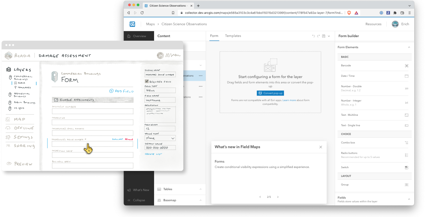
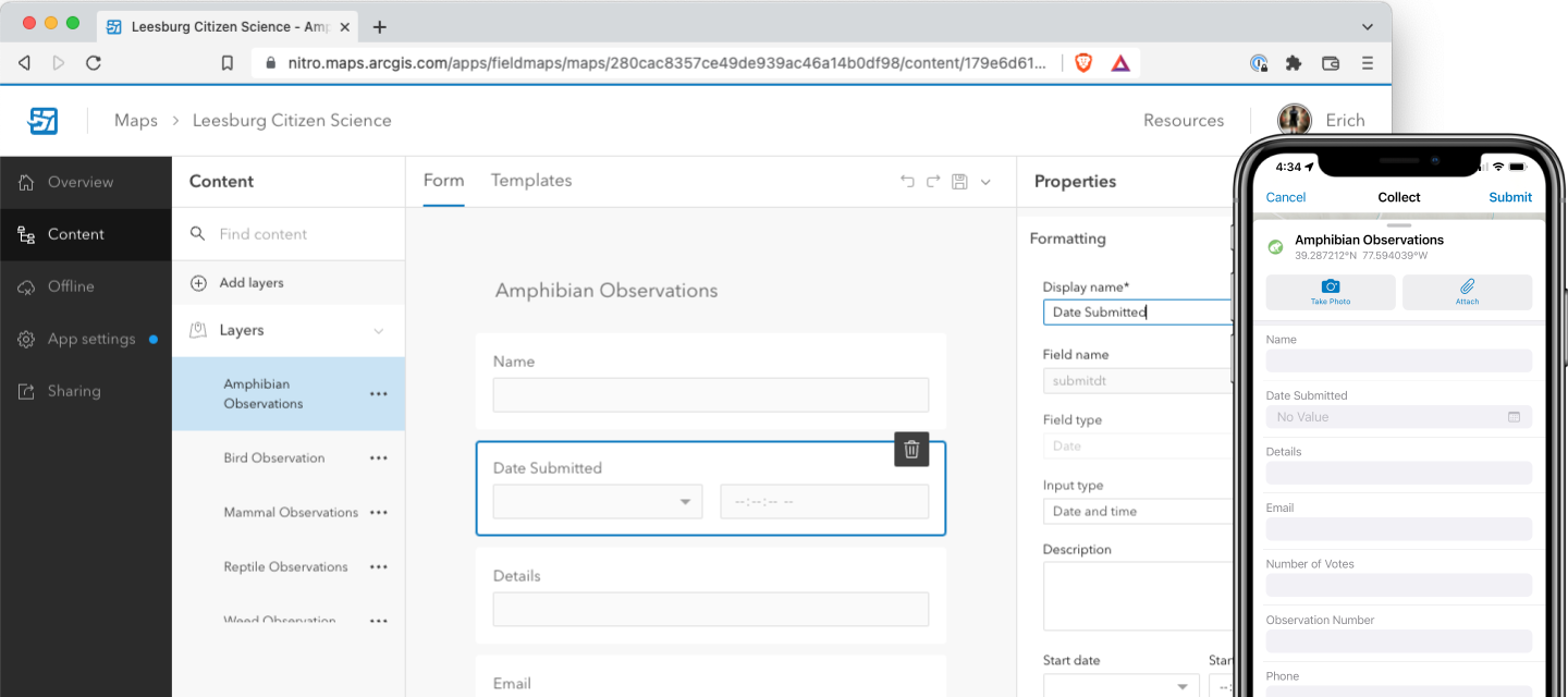
Forms were the second-most-fragmented surface across the three legacy apps. Field Maps needed a single, coherent forms experience — and the team's working name for it was Smart Forms. A form-authoring environment where supervisors could design the data-collection forms their crews would use, with conditional logic, calculated values, and rich field types.

The reconciliation problem was a structural one. The data model — feature classes, field definitions, domains — was template-first: you started from a schema and forms followed. But every customer interview said the same thing: people don't think in schemas, they think in forms. They wanted to draw the form their crew would fill out and have the underlying data structure follow.

We resolved this by treating templates as preliminary, scaffolded work happening underneath a form-centric authoring surface. The supervisor experienced the workflow as form-first; the system handled the template-first data model behind the scenes. That reconciliation is invisible in the shipped product, which is exactly the point — it was the hardest design decision in the product and the one that disappears when it's done correctly.

Smart Forms shipped inside Field Maps, then propagated. Aspects of the work later moved into the core ArcGIS web map product and other ArcGIS data-collection applications as adjacent teams adopted what Field Maps had built. The Smart Forms work was the highest-leverage design contribution of my Esri tenure — not because of how it looked in Field Maps, but because of how many other products in the platform it ended up shaping.

Smart Forms form builder canvas
Smart Forms — form builder canvas. Shipping product. The form-first authoring surface that resolved the form-first / template-first reconciliation.

04

Designing against two moving targets at once

Field Maps shipped on Calcite, Esri's company design system. But Calcite wasn't a finished system being consumed by Field Maps — it was a system being defined, in real time, through its first product implementation: the parallel redesign of ArcGIS Online's flagship surface, Map Viewer. Map Viewer was Calcite's proving ground. Field Maps was the second product through the door.

That meant the team was designing against two evolving things at once. Map Viewer as a product, with patterns and interactions still being decided by a different team. And Calcite as a system, with components, tokens, and guidance still being authored as Map Viewer hit each new design problem first. Routing around either one would have orphaned Field Maps from the platform on day one of release — a Field Maps that didn't look or feel like ArcGIS, built on patterns that diverged from where the rest of the company was heading.

The decision wasn't whether to absorb the coordination cost — it was how to structure the team's working relationship with Map Viewer so that absorbing the cost was sustainable. I established standing coordination with the Map Viewer team for status and feature consumption, built reusable components alongside theirs where Field Maps needed something Calcite didn't yet provide, and made sure our team consumed each Calcite pattern as it stabilized rather than waiting for the full system to land. The short-term cost was meaningful — every release window had a Map-Viewer-and-Calcite alignment pass — but the return was a Field Maps experience that felt native to the platform on day one, and a working relationship with the Map Viewer team that compounded across every release that followed.

Outcomes

Field Maps shipped, took its place as the canonical Esri field-data product, and replaced its three predecessors in the ArcGIS product line. It's still the field-data product today. What can be named:

  • Field Maps shipped as the field-data product for the modern ArcGIS platform — taking the place of Collector, Explorer, and Tracker in the product line and retiring them over the following years.
  • Smart Forms propagated beyond Field Maps, with aspects of the work adopted by the core ArcGIS web map and other data-collection applications as adjacent teams picked up the patterns the Field Maps team had built.
  • Offline map preparation moved from the most-fragmented to the most-cited reason customers migrated — a workflow that had been scattered across three apps' settings became a single sequential surface that crews and supervisors could learn in one session.
  • The design sprint at the start of the project saved months of misalignment downstream. The product manager and I have separately credited it as the most consequential five days of the project's lifespan.
  • A second designer was onboarded into the team, ramped on GIS-domain literacy, and partnered as co-lead — multiplier work that compounded across the remaining years of the product's development.

Reflection

The thing the project taught me, more than any specific design decision, was the leverage of upstream alignment. The five-day sprint at the start was the highest-return investment of the entire engagement — not because of what it produced, but because of what it prevented. Every scoping debate, every priority call, every "but our customers expect…" moment over the next two years started from a picture the team had already built together, rather than from each function defending its own version of the answer.

I've used GV-style sprints since, in different contexts, with different teams. None of them have returned what Field Maps did — but every one of them has saved time downstream that would otherwise have been spent re-litigating direction the team thought it had already settled. That has changed how I sequence work at the start of every project I've led since.

Artifacts